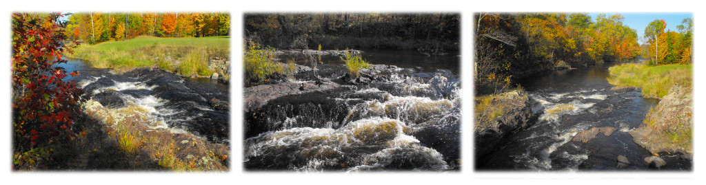
Waterfall Lower Part
46.486042° 90.26099°
10' high.
Located on the West Branch Montreal River (Hurley Area).
West out of Hurley on U.S. 2 for 3 miles, turn south (left) on Park Road
and continue 0.2 miles. Turn west (right) on Town Park Road.
Parking available on north side of river, before walking bridge.
Other scenic rapids and riffles are upstream.
Picnic area and pavilion available.
46.150491° 90.151973°
10' high.
Located on the Turtle River (Mercer-Turtle Flambeau Flowage Area).
North from Mercer on U.S. 51 for 1.4 miles.
Turn west (left) on County FF and proceed 5.2 miles.
Turn left at Iron County Park/Lake of the Falls sign.
Picnic and rustic camping facilities, boat landing with access
to Turtle Flambeau Flowage via Turtle River.
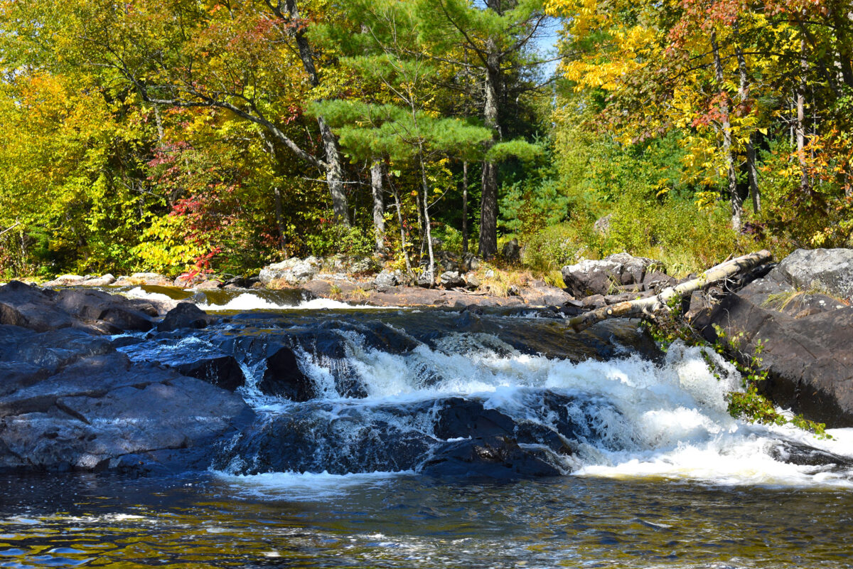
Foster Falls (east side - better viewing)
46.420819° 90.459129°
25 feet high. (Potato River) From Upson head north on Hwy. 122 for 5 miles.
Turn left (west) on Sullivan Rd. Travel 2 miles then turn right at sign (before river)
and go to parking area, falls will be on the left a short distance.
Foster Falls can also be viewed from the west side of the river, but the view is only the top of the falls.
* However, there are two other waterfalls that can be seen on this (west) side by following the directions below.
Foster Falls (west side viewing)
Travel west from Upson about 2.5 miles on Hwy. 77. Take a right (north) on Casey Sag Rd.
and follow approx. 5.2 miles. Take a right (heading east) on Sullivan Fire Lane for about 0.5 mi.
This portion of the drive is more rustic so proceed with caution. Continue to the parking area
for the North Country Trail (located right before the river). The falls can be seen by hiking the
North Country Trail (north) a short distance. You will see the top of Foster Falls, but if you
continue on you will see two other waterfalls. The first one is about 0.2 mi. from the parking
area and the other another 0.6 mi. NOTE: Foster Falls itself can be better viewed from the
opposite (east) side of the river, see above.
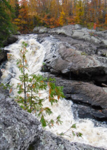
46.347726° 90.239342°
20' high.
West branch, Montreal River.
From Hurley via U.S. 51 south, travel 4.5 miles.
Turn right (west) on County C.
About 1.5 miles west, the county road turns sharply north - don't take that.
Continue forward on the gravel road (Island Lake Road).
After about a mile it turns south, follow Island Lake Road about another 3 miles
to Falls Road. Turn right, go about 1.3 miles.
Follow rustic path signs.
*OR from Hurley traveling west on Hwy. 77 go about 4 mi. to South Elm Street,
turn left and follow approx. 0.4 miles to Spring Camp Road,
turn left (south). Travel 5.1 miles along Spring Camp, (you will cross West Branch Rd.)
to a rough logging road on the left. Follow 0.9 miles to falls.
ATV/UTV access via Trail 13.
N46.370681° W90.479515°
15 feet.
Travel west from Upson about 2.5 miles on Hwy. 77.
Take a right on Casey Sag Rd. One mile north of Hwy. 77
on Casey Sag Rd. near the rustic trail on the left (west).
Then it is about a 0.75 mile hike.
No ATV access.
N46.407357° W90.516937°
15 feet.
Tyler Forks River.
From Hurley travel west on U.S. 2 about 17 miles to Hwy. 169.
Turn left (south) on Hwy. 169 and go about 5.5 miles.
Take a left (east) turn on Vogues Rd. Follow the gravel road for
3.5 miles until a hairpin turn.
Where the road forks take the center road to the south
for about 1.5 mile.
From there hike up the hill to a primitive campsite above
the north side of the falls.
*OR from Hurley travel about 15 miles west on Hwy. 77 to Casey Sag Rd.
Turn right (north) and travel about 12 miles up to Vogues Rd. (do NOT take Vogues Rd).
Take the road on the left (south) and continue about 1.5 mile.
From there hike up the hill to a primitive campsite above the north side of the falls.
No ATV access.
We invite you to enjoy the Waterfalls of Iron County, located in northern Wisconsin, as perfectly natural now as when they were discovered. You’ll find some of the most spectacular waterfalls in Wisconsin here, both in height and surrounding scenery. Most of Iron County’s many waterfalls are located off-the beaten path, unspoiled by crowds. Play it safe around these natural areas—use care and enjoy the falls from a safe distance.
Waterfall Upper Part
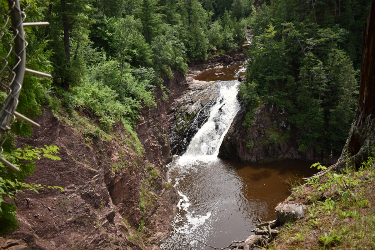

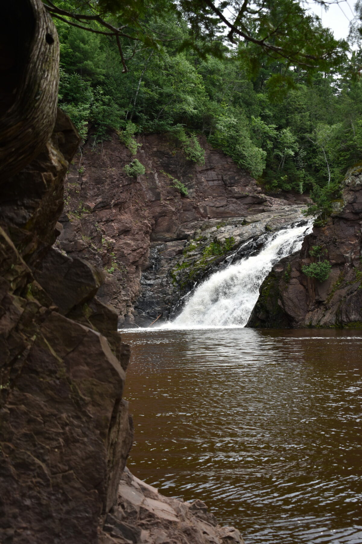
46.535797° 90.380255°
90' high.
Located 14 miles northwest of Hurley, WI and Ironwood, MI.
A big falls on the Michigan/Wisconsin border. When the water is
high it is especially impressive. The gorge below the falls is one of
the deepest in the Midwest.
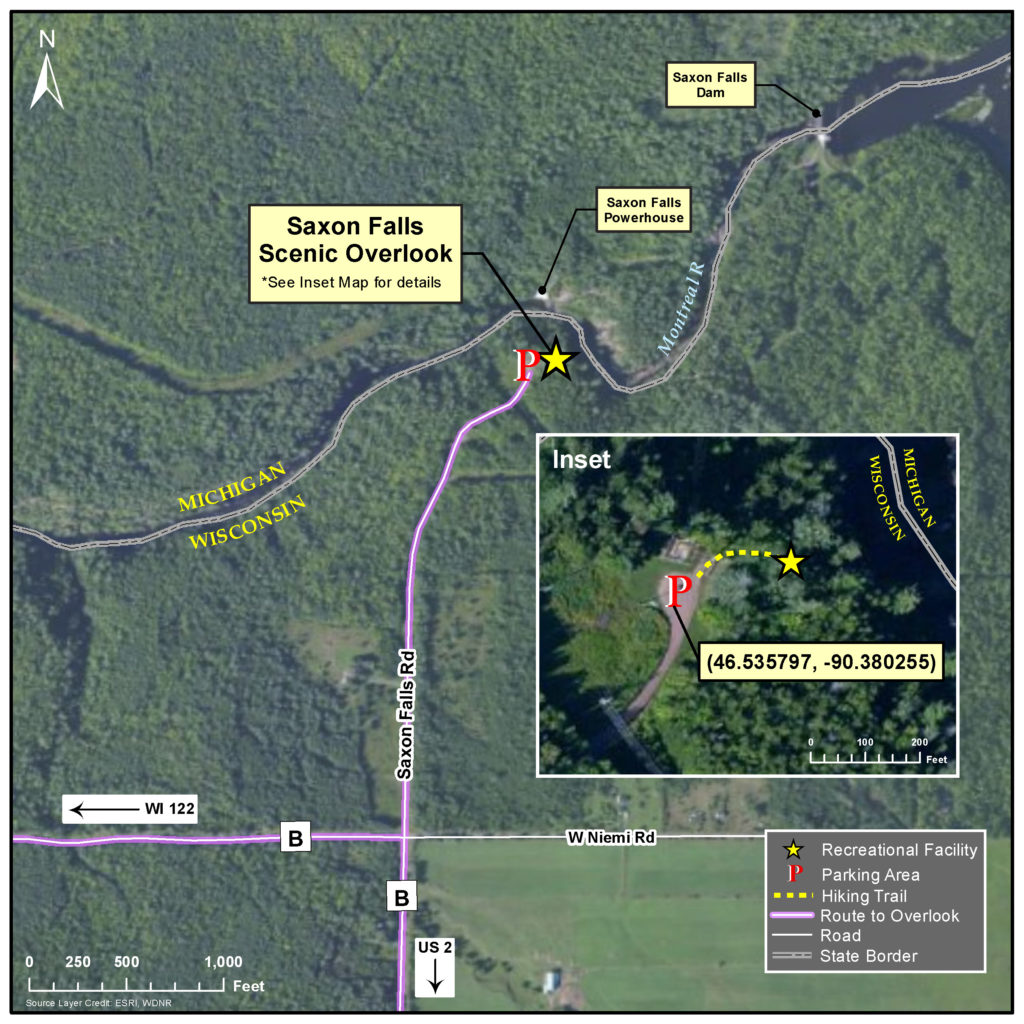
Directions to the Saxon Falls Overlook
From Hurley: travel about 11 miles west on U.S. 2 to the intersection with County B; head north on County B
for roughly 2.7 miles at which point County B will curve to the west; do not follow the curve, but rather continue
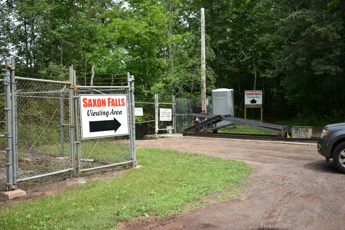
north on Saxon Falls Road (unpaved) down the hill approximately 0.5 miles to the unpaved parking area. On foot,
follow the short, wooded hiking trail to the east of the parking area, which leads to the overlook location.
From Ashland: travel about 26 miles east on U.S. 2 to the intersection with WI Hwy. 122; head north on WI Hwy. 122
for roughly 1.6 miles, then veer easterly (right) onto Berg Road (unpaved) and continue for an additional 0.4 miles to
the intersection with County B; travel east on County B for an additional 1.9 miles, at which point County B will curve
to the south; do not follow the curve, but rather turn north on Saxon Falls Road and continue down the hill approximately
0.5 miles to the unpaved parking area. On foot follow the short, wooded hiking trail to the east of the parking area,
which leads to the overlook location.
Please note: the overlook can be safely accessed only from the Wisconsin side of the Montreal River.
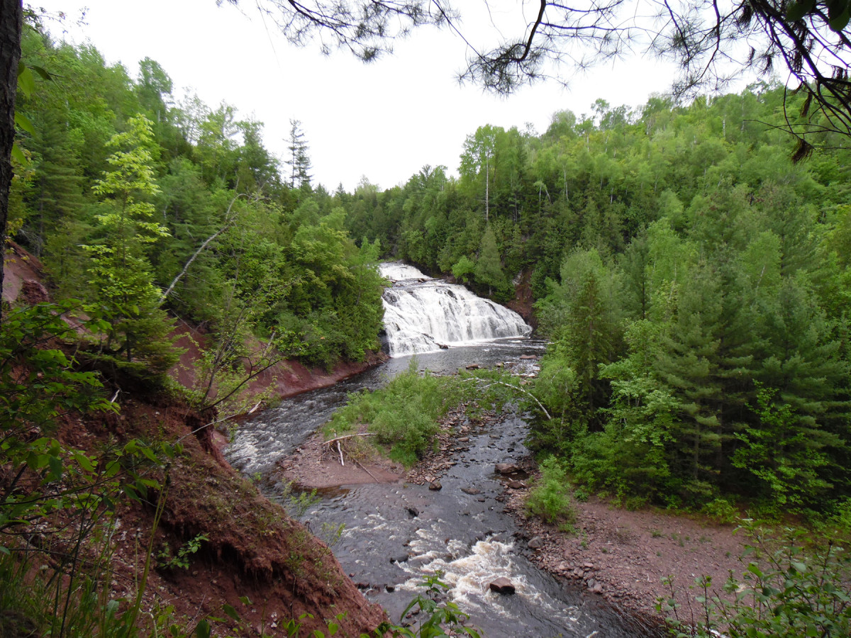
46.461142° 90.53032°
90' high.
Located on the Potato River (Gurney Area).
Head south from U.S. 2 on Hwy. 169, 2.8 miles (through Town of Gurney).
Turn west on Potato River Falls Road, continue for 1.5 miles.
Town park with rustic picnic campsites available.
You will navigate stairs to both falls. There are 131 steps to the Upper and 204 steps to the Lower.
ATV/UTV access via routes.
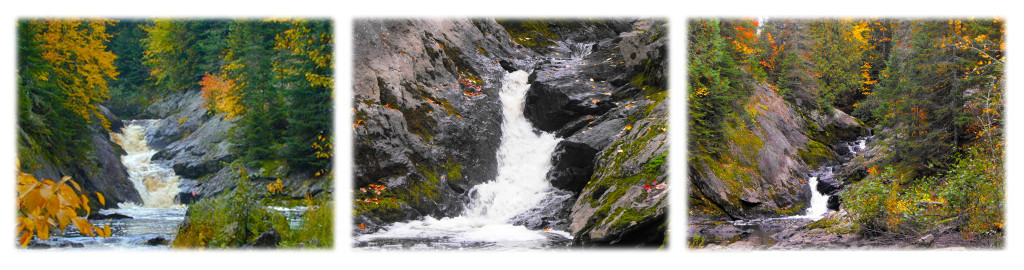
UPPER FALLS LOWER FALLS

46.47552° 90.20085°
18'
Located on the East Branch Montreal River (Hurley Area).
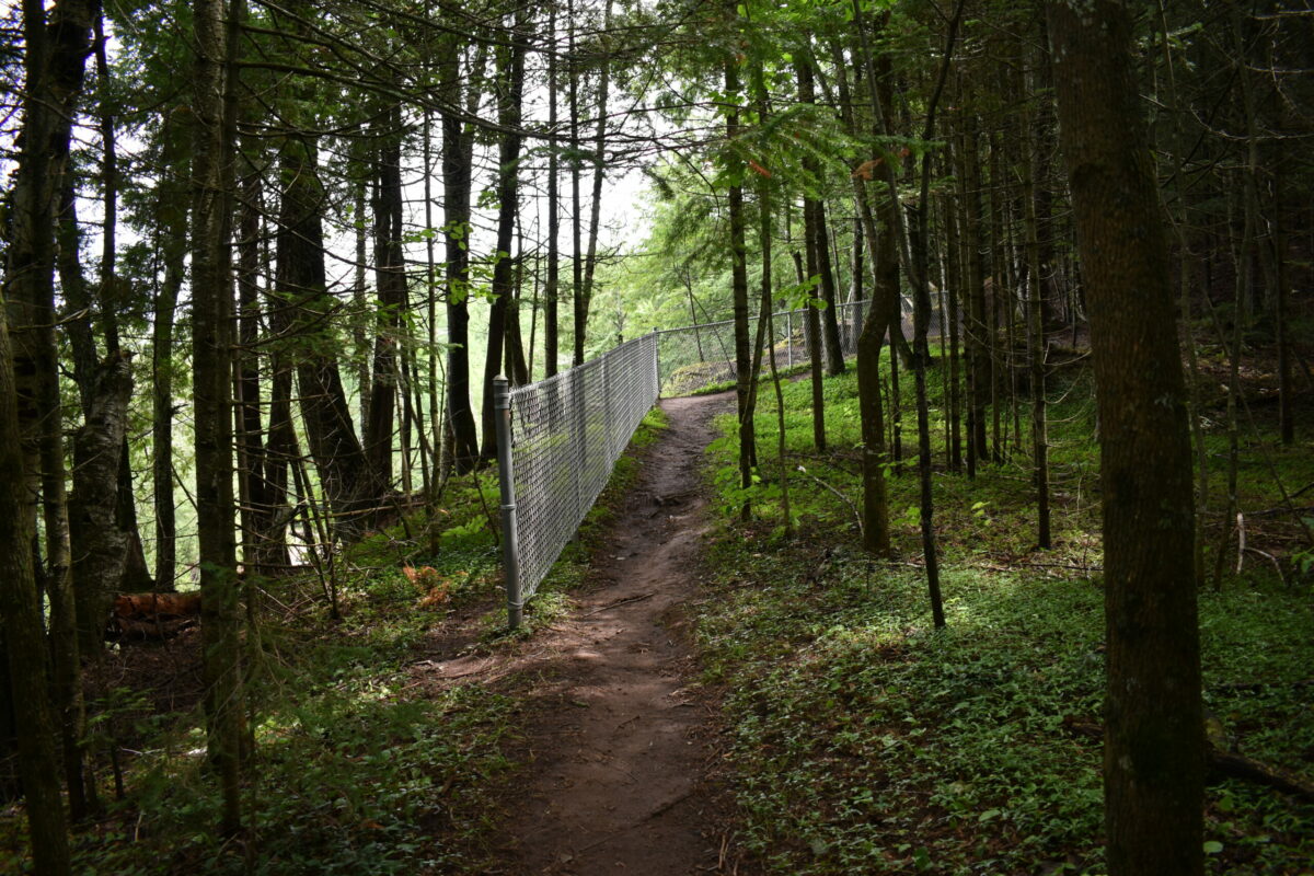
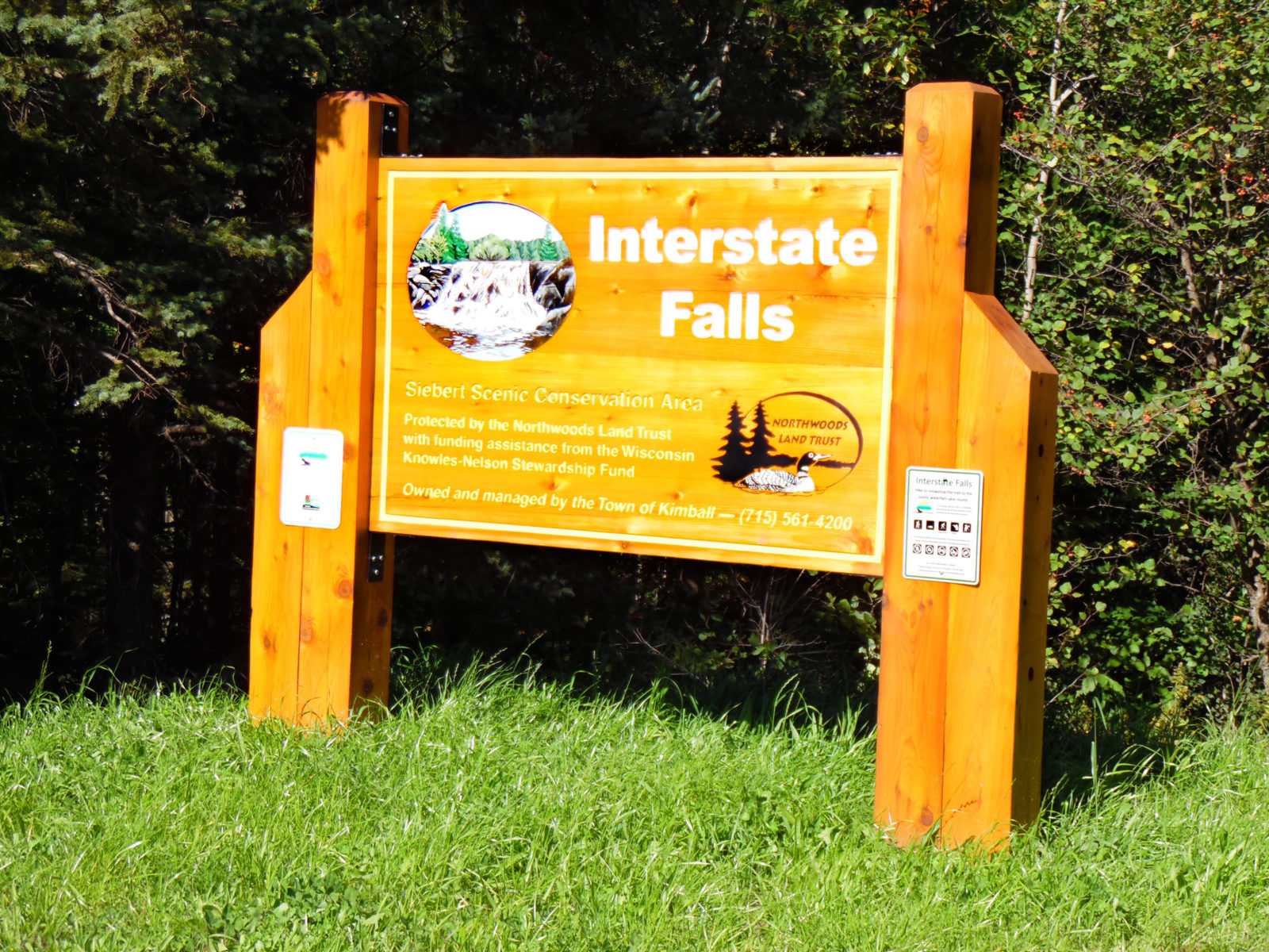
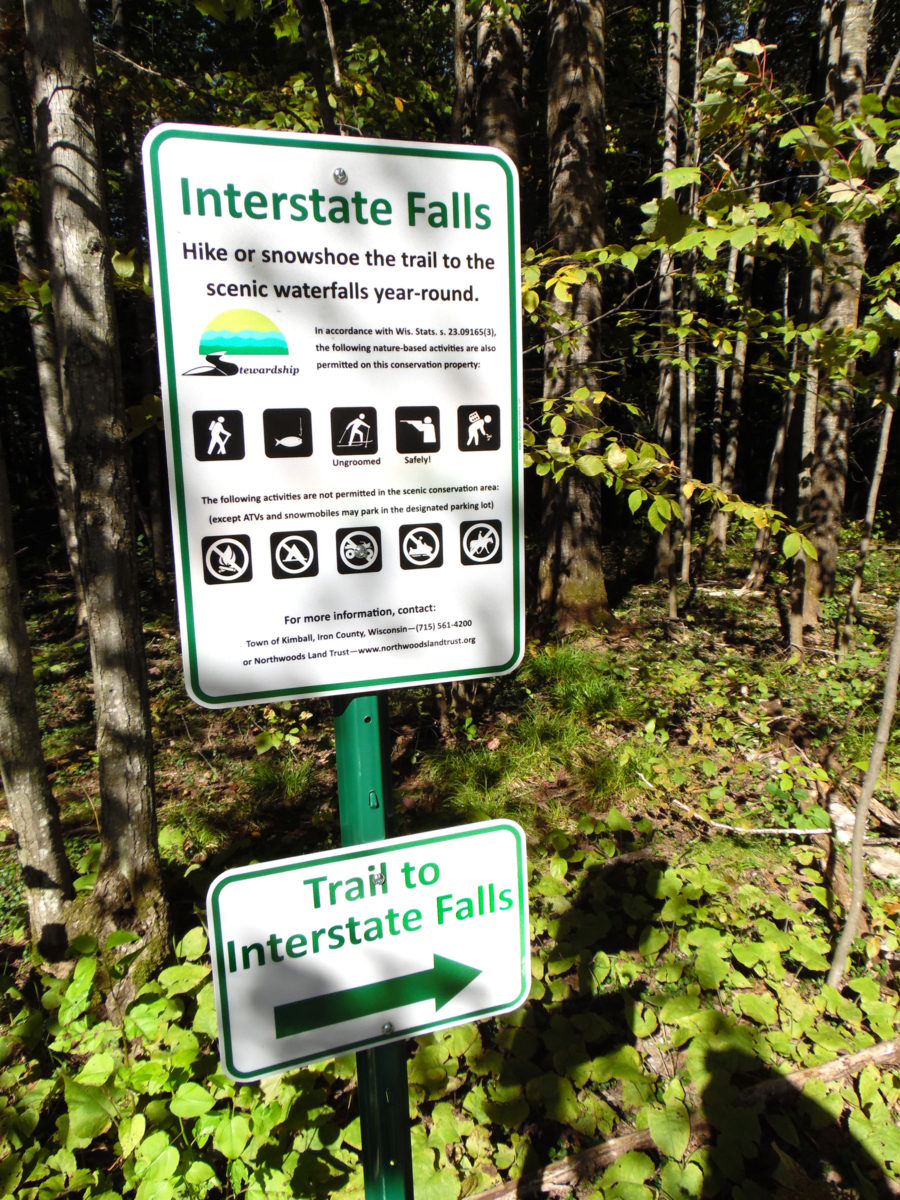
Take U.S. 2 west of Hurley for 0.6 miles to gravel road at Interstate Falls sign.
Follow road straight east – do not take any side roads.
Continue for 0.3 miles and park at large parking area on the left.
Follow the trail to the north to visit Interstate Falls.
(Interstate Falls is downstream from nearby Peterson Falls which is "closed to the public".)
The trail is 0.3 mile long.

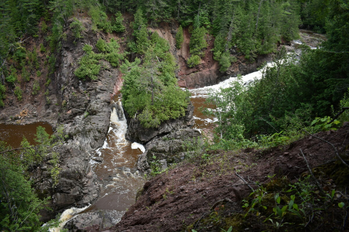
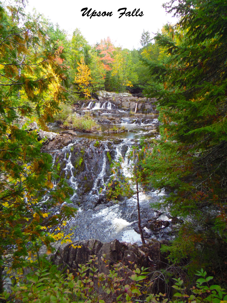
46.371214° 90.412041°
18' high.
Located on the Potato River (Upson Area).
Take Hwy. 77 west from Hurley into Upson.
Turn north at Upson Town Park sign, then left at end of street.
After crossing the river, turn left into Upson Town Park.
Camping & Picnic area available.
*Campground & bathroom closes at the end of October.
ATV/UTV access via routes.
15' high.
Located on the Turtle River (Mercer Area).
Head east on County J in Mercer for 2.5 miles.
Turn north (left) on Beaver Lodge Circle.
Proceed 3.6 miles, passing Beaver Lake Road.
Turn east (right) on Fisher Lake Road 1.2 miles to
small side road on the left leading to Shay’s Dam.
Watch for “Shay’s Dam” sign.
Park with picnic area available.
No ATV access.
Request a "Waterfalls Brochure" at either of these two chamber offices: